Outsourcing Consulting News
Geo location dashboard development, realtime fleet mapping, geofencing
The Customer
The client is a Colorado-based technology company specializing in online tracking solutions for the transportation industry. They offer a way for companies to keep track of their assets via a variety of small tracking devices, which operate globally over satellite, cellular and other wireless networks. These devices report movement and any other changes you dictate, giving you not only current position, but also a historical activity log.
Business situation
The company is looking for a new ways to improve their customers' satisfaction by delivering a new level of integration between Analytics Tool and Geographic Information Systems in the form of spatially enabled Management Dashboards.
Solution: Geo Location dashboard and software for real time mapping, geofencing, fleet monitoring
The solution allows users to utilize web based geospatial dashboards with Google maps and charts that are tightly integrated to enable powerful visualization, analysis and simulation of data in real-time.
Main Features
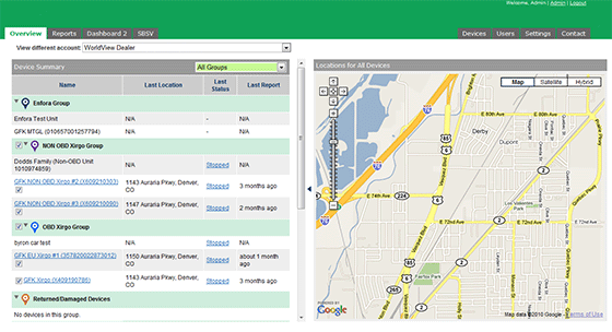
Real time mapping interface
-
Geofencing and notification of critical events
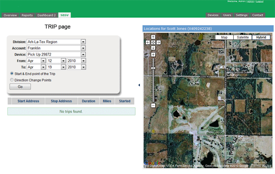
Historical activity analysis
Speeding reports
Engine idling summary
Mileage and hours of service
Automatic geocoding of all location events
-
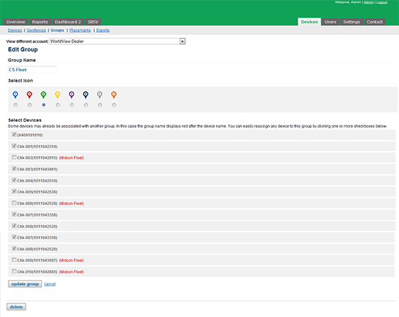
Fleet management tools
-
Automatic refresh on fleet overview screen
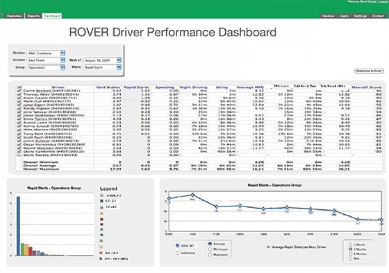
The data set available for analysis is tied to the individual's permissions (User, Administrator, Master Administrator, or Super Admin). Summary analytics can be performed on a collection of devices with the following options available:
- Ability to select a time period for analysis
- All normalized metrics used in scoring available for analysis
- Ability to pull up individual Scorecards
- Trend capability with all metrics (graphical and tabular)
- Export capability
Technologies
RubyOnRails, Google Maps, CSV export, FTP client, AJAX